

Crossing the International Dateline
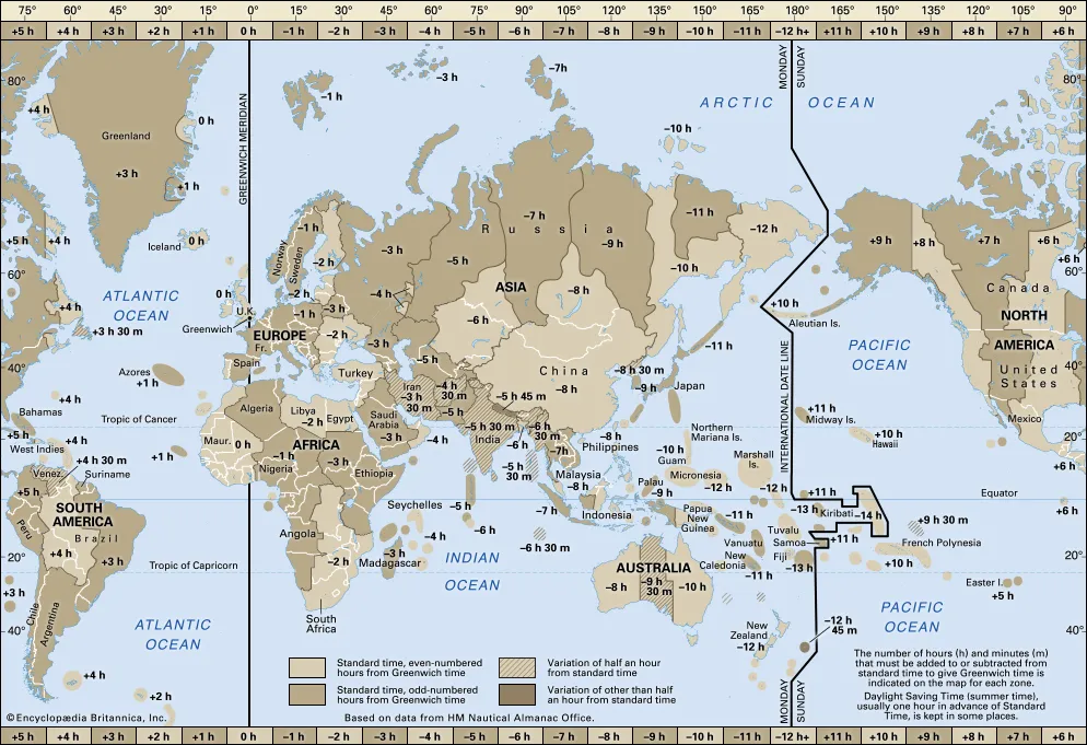
Crossing the International Dateline is getting more attention lately as an imaginary north-south line across the globe that gives us our global time schedules. Not until the 1884 ratification did this become a global agreement between states and nations. The IDL is roughly based on the meridian of 180° longitude, roughly down the middle of the Pacific Ocean, and halfway around the world from the IERS Reference Meridian, the successor to the historic Greenwich prime meridian running through the Royal Greenwich Observatory. In many places, the IDL follows the 180° meridian exactly. In other places, however, the IDL deviates east or west away from that meridian. These various deviations generally accommodate the political and economic affiliations of the affected areas. This is the case with our sail today as the island nation of Samoa, prides itself to be a First Nation in the new day. When the IDL circumscribes Kiribati by swinging far to the east, almost reaching the 150°W meridian Kiribati’s easternmost islands, the southern Line Islands south of Hawaii, have the latest time on Earth (UTC+14:00 hours).
A better explanation
South of Kiribati, the IDL returns westward but remains east of 180° longitude, passing between Samoa (172° west) and American Samoa (170°west). In 2011 the island nation of Samoa decided it would skip Friday, December 30, and move straight to Saturday, December 31 and since then operates at the east end of the Int’l Date Line. Their main reason for this change was being able to trade with their Australasian Trading partners during the same day.
So even though we never crossed the 180° meridian to truly pass the dateline, we passed the equator to the south and the current official Int’l Dateline to the west.
For the ship’s entertainment department this crossing was reason enough to bring out the big party guns. Dancers, musicians, King Neptune and the Shark and tropical drinks galore. Nobody realized that we just lost a day.


Recent Comments